Municipal GIS Management System for Mpumalanga
Several municipalities faced severe revenue leakage, billing inaccuracies, and inefficient asset management due to disconnected, non-spatial data systems. Municipalities lacked a unified view of their property base, service connections and payment records, undermining financial sustainability.
The Challenge
Our Role & Action
As Project Manager, we oversaw the development and rollout of an innovative GIS-based service and revenue management tool.
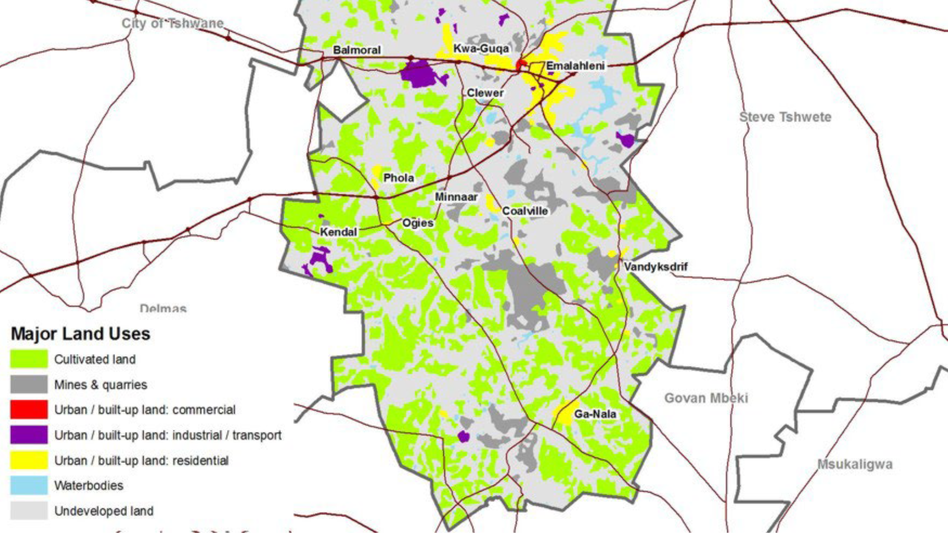
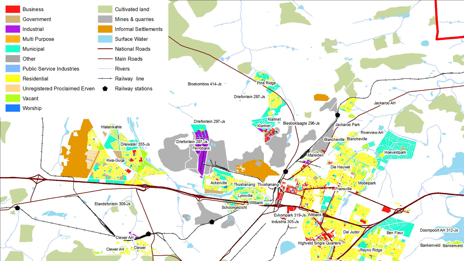
System Design: Directed the creation of a system that spatially integrated the valuation roll, billing data, utility meters (water/electricity), land use, and payment records.
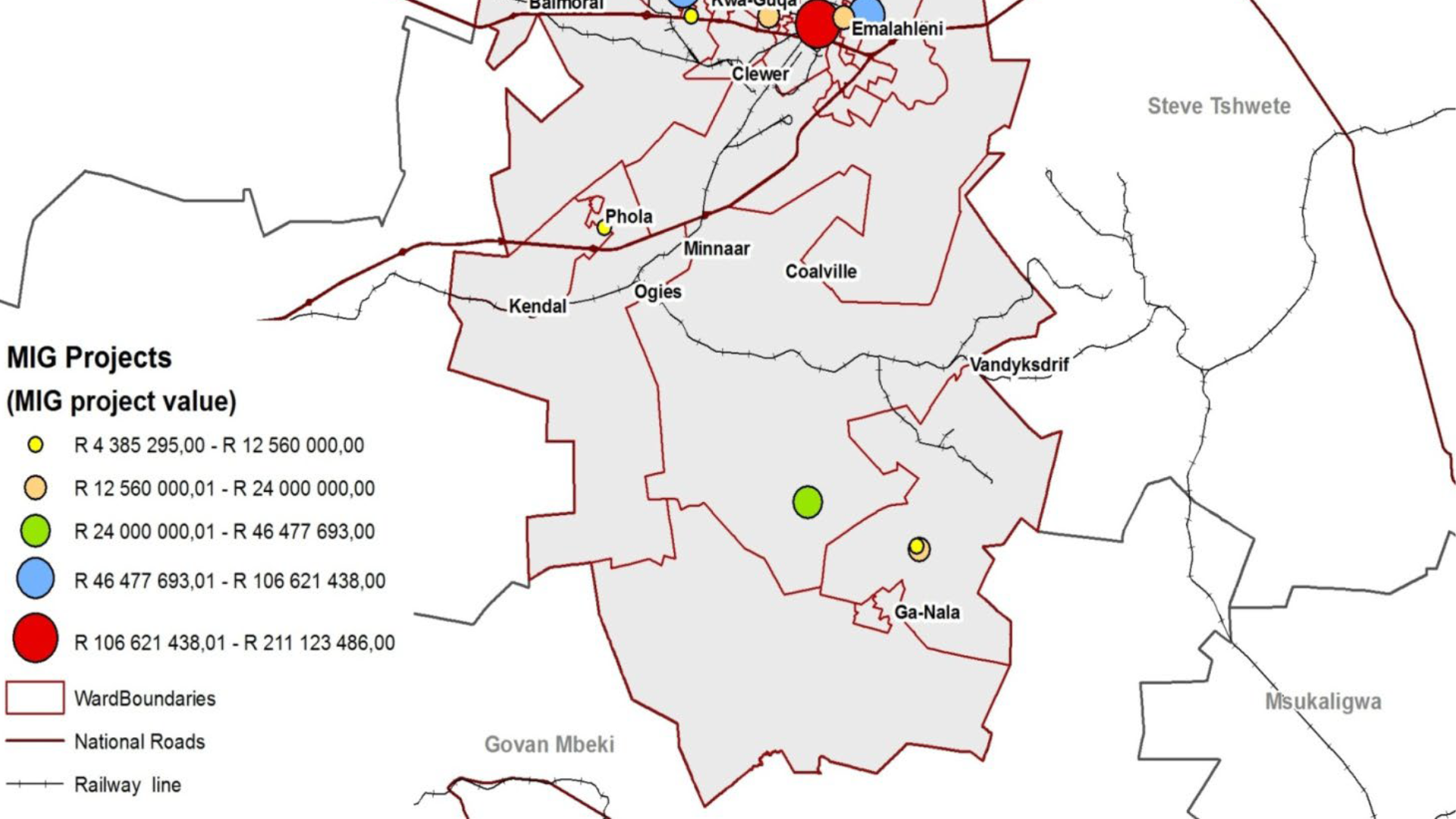
Pilot Implementation: Managed the rollout in 4 pilot municipalities, including staff training and process integration.
Data Interrogation: Led the analysis that used the new system to cross-reference data layers and identify discrepancies.
The system immediately identified significant service leaks, illegal connections, billing errors, and losses due to contractual discrepancies.
Enabled municipalities to implement targeted, simple interventions, such as correcting billing addresses, identifying unmetered connections, and auditing contracts, based on concrete data.
Resulted in a 15-35% increase in own revenue for the pilot municipalities within a short period, dramatically improving their financial health and capacity to deliver services and target maintenance issues.
The Impact